Presumptions

With winter in, the days are short and the nights are long. This usually leaves me indoors behind the glow of a computer screen. I tend to find myself pouring over online topo maps and digging deep to find obscure beta on trips and routes that will be possible in the following months, when the temperature rises and the snow begins to melt. Combining different modes of transportation on obscure, often overlooked sections on a map.
I find new ways to connect the dots on a map, an interesting pursuit. More importantly, when I find ways to connect the dots, I try to see if there is any information online about this. At the least, there will be vague blog posts or image results of past trips in the area. That's enough of a morsel to get the gears grinding out contrived loops and routes through "un-marked" seldom visited areas on a map.
We are never the first though. Inevitably... once we attempt these routes, there will be signs of past people that have walked through this place. I was reminded of this camping in a remote section of river along the Escalante. Now I know people hike this river constantly when the temps are high and the water ankle deep. The area we were in was miles from the nearest, seldom visited side canyon, and the walls adjacent to us, were tall and boulder strewn. Before nightfall, I left camp and wandered up towards the high flood mark along the hillside to relief myself out of view from the others. Only there did I notice a faint social trail paralleling the river. People have walked here before. Actually a fair amount of use to leave the tell signs of human foot traffic. This doesn't account for all foot traffic that others hiking down the river. This social trail before me is only from the few that are tired of walking in the water and have retreated high enough to avoid the willows and other vegetation that choke the river bank. Although the trail was faint and old. No one had walked on it in months. Or at least a handful of rain and wind storms have removed any recent signs of use. The soil had began it's slow process of removing any sign of past hikers. That crust that forms when soil is undisturbed for an indefinite amount of time.
The following morning, we cleaned up camp, loaded the boats and pushed off. Although It may look like we were the first to have camped there, We certainly weren't and we won't be the last. I find a great satisfaction in leaving places better than I found them. It had me fooled till I wandered up there. This place is a sencuary. It's still so remote and difficult to visit, for being surrounded by towns and highways within a 100 mile radius. Even for the western states though, it is a rugged area to visit and explore. These weeds out large crowds. Keeps it serene and undeveloped.
A couple weeks prior to this experience I looked at the long range forecast to see if there should be anything to worry about or more importantly be excited about. You know that urge as trips get closer, anxious busy work.
It called for rain.
Ten days away is a long time to predict the weather. But dammit it was right. The refresh button was pressed several times a day over the following days as the dates got closer. Odd behavior. One day would call for sun and the next would call for rain. Research was done for the most reliable forecast websites. (Weather.gov was what I was told.) As the days grew closer, plan B was discussed. Plan B's have been a successful alternative in the past few years for us.
This trip was the first successful plan C. Plan C is actually the original plan A, it only occurs once you abandon plan A, decide on plan B and then reconsider plan A miles down a dirt road at the turn off for plan A. It has a similar feeling to being in the middle of the storm, you've given up hope for your original plans and have convinced yourself you have made the right choice. Shortly after this decision, the sky clears, the sun comes out, your schedule frees up, and you arrive at this fork in the road. A decision that wasn't possible 2 hours prior has resurfaced as a possibility.
Pulling out of the garage, it didn't take long before I had to turn on the windshield wipers. Once on the freeway, I turned the wipers above the intermittent mode to as fast as the wipers would allow.
It was coming down.
Then mid May in the American Southwest, up on a mountain top in Utah, it started snowing on us.
I'm going to float a river tomorrow, I thought to myself. It was 38 degrees outside as we dropped off Cedar Mountain. Once we got below 6000 feet, I checked the temperatures again. Oh good, It was Three in the afternoon and 43 degrees out now. Awesome.
Before loosing service I refreshed the weather forecast one last time. From what I could gather it was going to rain most of the night and into the following morning. By midday it was suppose to clear and only call for scattered storms for the next few days. Not a bad forecast for most areas but the others in my group that had a similar forecast before hiking down into Coyote last summer, It was not a comforting feeling having that in the back of your mind.
Moose, Kb, Cami and a few others hiked Coyote in the peak of the summer heat last year during monsoon season. The canyon was almost void of people. They spent the afternoon concerned about the lack of water down there, only to be laying in the shade at camp in the afternoon heat listening to the calm breeze blow through the canyon, and the slow rumble of the cottonwood trees dancing in the breeze, only to look up and realize there was no wind and the trees were not moving. My God...
With that discovery only then did they look over to find a river of mud, chocked full of trees and debris. The once small trickle of water that slowly meandered down the canyon was replaced with a violent torrent of rainwater and earth. The next morning after the water receded, they had to hike miles through deep slimy silt to reach their car. I was at home watching their progress via their Garmin in-reach, wondering why they were taking their lollygagging time as the little dot on my computer screen seemed to crawl through the contour lines of the map.
The idea of watching all this rain coming down out the car window and knowing where it all has to eventually go was not a comforting feeling knowing we were going to be possibly floating in it tomorrow.
This was the mood pulling off the pavement and onto the first camping area off HITR road. The rain had let up which was comforting, 200 yards down the road, the rear end of the car got loose and began moving around to orient us perpendicular to the road and our desired direction of forward progress. Not promising. I've never been down this road when it was fully saturated. Only sunny skies and deep dusty washboards. Now I know. The rain stayed away most of the night and rolled back in at first light. I crawled out of the car and got coffee going and retreated to the safety out of the rain under a large juniper tree to enjoy the morning mood the clouds and rained brought to the landscape and had some coffee. The tent that resembled an eagles nest next to us was a Subaru and a Tepui tent mounted on top. They noticed the strange sight of me, in the rain, under a tree, reading a book in the gloomy morning light. Chuckles seeped out of the tent.
We took our time and broke down camp that morning, and headed south down the road. After a few quiet moments in the car and switching into 4wd we pulled off the road to wait for the clay to dry out enough to make anymore forward progress. Damp sage and water logged juniper limbs were gathered and an embarrassing smokey fire was eventually born. It was too late in the day to get the cars shuttled and down to were we need to be at this rate. We were 10 miles down and it took roughly an hour. Discussions of alternative plans were floated around. The idea of it being possible to get out of the mud filled mess we were in seemed futile. I could hear the rumble of a trucks engine over the hill and I walked up to the road to find a few trucks coming around the bend.They were struggling to keep the wheel pointing forward and out of this place, they spun around and danced along the road from side to side. I cheered them along as the white knuckled past me.
An hour or two passed and a few beers later we decided we should try to get further down the road once more and get to Davis later in the afternoon, much to the girls adamant protest to our decision. I eventually learned we were 95% through the clay sections of road when we put up a stop sign and pulled over. With us waiting around for a couple hours, the clouds were clearing and sections of blue sky were now visible. It took us an hour to get 12 miles down the road to that point. A very slow pace indeed. Once back on the road and a mile further down we were now a comfortable 45 mph was a welcomed surprise I had no idea was possible an hour ago with what was being dealt to us.
This is when we reached the turn off for Crack in the wall. I brought the car to a stop and waited for the eagles nest to arrive. This is when we decided it was still possible to put in at Fence and float the 40 miles of river down to Crack in the wall in 2 days and if we needed more time we could put a few miles in the morning we needed to hike out. Our past trip was a larger group and we spent more time soaking in the scenery, hiking and waiting for others to get down through the boulder chocked river. 20 miles days are long with such a small meandering river that is constantly lined with rocks and sand bars.
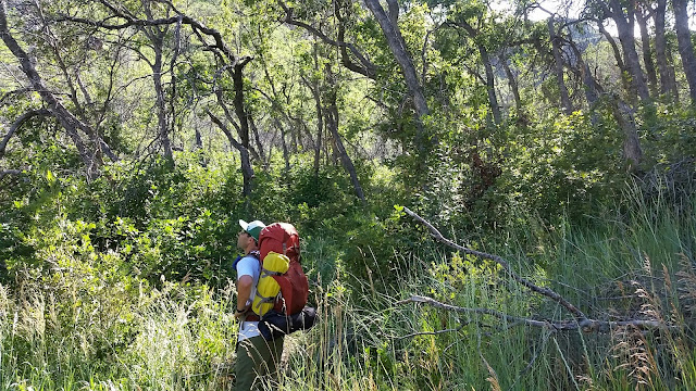
Parked at the take out was a frantic scene as we rearranged gear and tossed what we thought we needed for the next few days into our backpacks and quickly headed back up towards our put in with a goal to still hike down to the river that afternoon. The cars that lined the parking lot were still clean and mud free from heading down a few days prior. I imagine it being wet and cold the last few nights down there with the weather we have had.
An hour and thirty rough washboard miles later we arrived at the put in with scattered clouds and mild temps. I packed and repacked all my gear, through a few items in and took a few items out once I realized how much me pack weight was. I understand we are floating a river but when you have to carry all of that stuff down a few miles it makes you second guess every item if it really is essential. During all of this a large storm cell was brewing over fifty mile ridge behind us.
And that's all it did. Looked dark and angry as it fell behind the rim out of view.

We had hiked down to middle earth and what sky we could see above us was a calm, moody and most importantly, not threatening.

I am a broken record. Mornings are my favorite time of day.

With 20 mile days ahead of us, we wasted now time getting up and at it. Pretty sure we were on the river by 7:30 every morning.

Only 1 mile in and we took a side hike. The views were far from boring and the zipper issues kept reminding us how easy it is to be in deep shit real quick down here. After a few different cleaning methods, we got one troublesome Tizip to hold air. Crises avoided.

Cami in the Cathedral. We had it to ourselves for as long we we could spare. I think my priority's were off. One should stay here as long as it takes the canyon to be fully lit by the Sun.

Varnished walls around every corner.

Camp #2 on a small sandbar. Remote place at first glance, but if you wandered long enough, there was past signs of others traveling through on foot. We spent a long evening here, laying on the rocks, staring up at the cliff bands above, watching the sun fade out and the shadows swallow the canyon whole.

Morning light and colors painting the cliffs above camp. We are halfway down through this small ripple in the Earth.

Every turn the landscape changes. I don't recall any part of this river attempting to copy itself as it cuts deeper into the sandstone. You follow the river down canyon and around the next S turn the walls have new, different features and the morning light makes them take on different colors. What a place.

No named feature on the maps. There are several of these. After paddling all day, back at camp I checked areas on the map to see if any landmarks from the day were named. Most were not. Left for us to interpret at our own discretion.


Lunchtime.


Obligatory stops along the way to stop and look around.

The lower canyon has far more undercuts and alcoves. Indications of the approaching popular landmarks.

Final few bends in the river and we are done. Rafts are deflated and loaded back onto our backs. One long sand dune climb out and we break through the rim onto the esplanade back towards our car.
The End.
It was a good time, would do it again.

Comments
Post a Comment